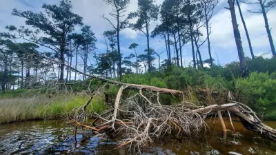
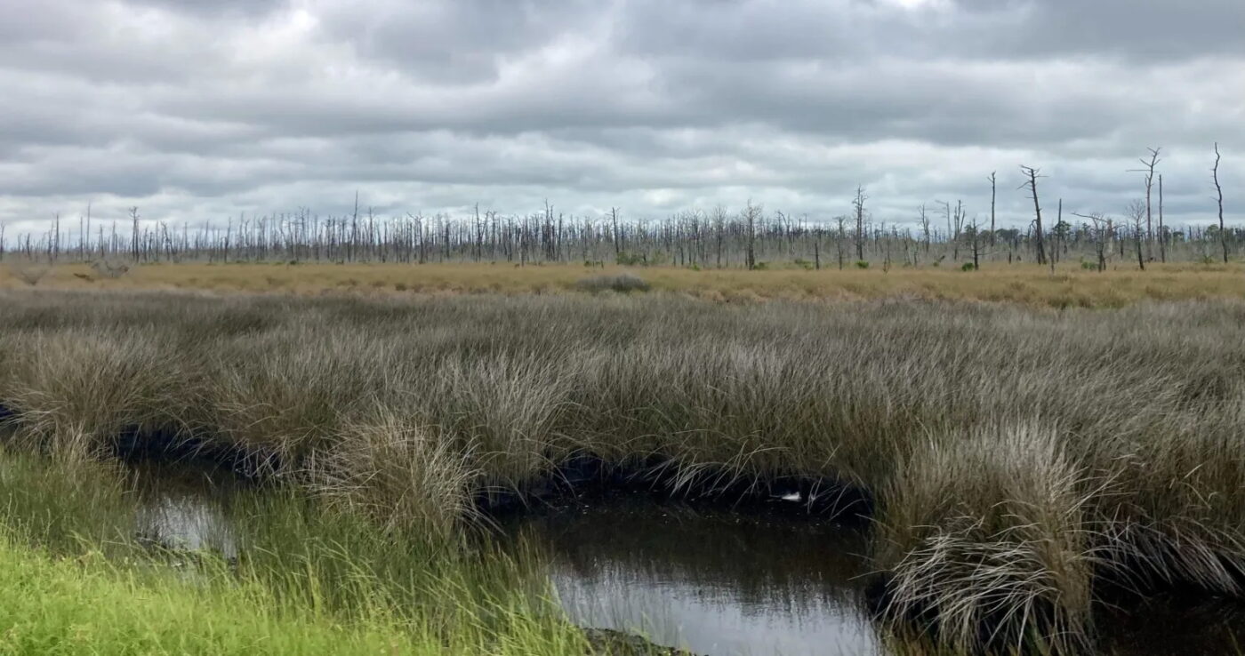
Dozens of eerie, bleached-gray pine trees stand on the marshy shore of Harkers Island. Their trunks are like telephone poles — leafless and lifeless exclamation points amid a tract of island woodland 50 miles southeast of New Bern.
As the salt marsh transitions to wetlands and to maritime forest, the trees are in various stages of decomposition — some fallen, others still lush and green, nestled in thick undergrowth. Though some trees are still living, they are under threat from sea level rise and other impacts of climate change.
The spreading stands of dead trees are what’s known as “ghost forests,” a general term to describe contiguous areas of dead trees. And they are the focus of Duke University ecosystem ecologist and biogeochemist Emily Bernhardt’s research.
A decade ago, Bernhardt noticed large sections of dead trees along Interstate 40 near Wilmington. Around the same time, on North Carolina’s central coast, she and colleagues observed a kill-off of young trees in a forest restoration project near Columbia, on the Albermarle Sound in Tyrrell County. Most were likely a casualty of increased salinity in waters edging the forest.
“At the time, it was surprising to us,” she said. “Suddenly, more and more people were saying, ‘Oh, wow, I’m seeing these dead trees.’ It sort of slapped us in the face.”
It was, in fact, the launch of a steep change in the range of ghost forests on the North Carolina coast.

Since then, field observations and satellite imagery confirmed that the die-off of coastal forests is widespread in North Carolina and throughout the southeastern Atlantic coastline. Recent mapping by coastal ecosystem scientist Elliott White Jr. of Stanford University and biogeochemist Emily Ury of the University of Waterloo showed a meaningful acceleration of deforested coastal wetland on the East Coast from 1996 to 2016.
“Now we know that it was, in fact, a rapid expansion of ghost forests,” Bernhardt said.
Yet, scientists are now just getting a handle on the geographical scale of coastal tree loss.
Although the ecological implications of the spread of ghost forests are uncertain, what’s likely is that once forests die, they are unlikely to be replaced by other trees. One certainty is that ghost forests are forming as fast as ever, aided by sea level rise and other changes elevated by a warming climate, such as more severe droughts and more powerful storms. Combined, as the sea level rises and salt water seeps inland, coastal forests may erode faster than they can recover.
Perhaps the most alarming aspect of the spread is that scientists don’t know how to stop it.
Even with the tools to track the expansion of ghost forests, scientists and policymakers are challenged because the movement of salt water over a complex landscape is difficult to model and predict.
“We’re talking about forested wetlands, which are these beautiful, iconic, special places. They’re biodiversity hot spots. They store a ton of carbon. And we’re losing them at a really rapid rate.” — Duke University ecosystem ecologist and biogeochemist Emily Bernhardt
Maritime forests, such as the patch of forest on Harkers Island, are an important ecological defense from the constant battery of waves and wind along the sea. They provide structure to the shoreline, support biodiversity and form a barrier to protect less wind-tolerant plants.
As storms and extreme weather frequently torment this vulnerable portion of the North Carolina coastline, the forests help lessen the upheaval felt by those who live, work or visit the coast.
The lands where sea and land meet are also a deeply meaningful cultural landscape rooted in a centuries long human connection.
“We’re talking about forested wetlands, which are these beautiful, iconic, special places. They’re biodiversity hot spots. They store a ton of carbon. And we’re losing them at a really rapid rate,” Bernhardt said.
And as sea levels rise, among the pressing questions for researchers is understanding ghost forests, their scale and what, if anything, can be done to counter their expansion.
Inland forests dominated by water
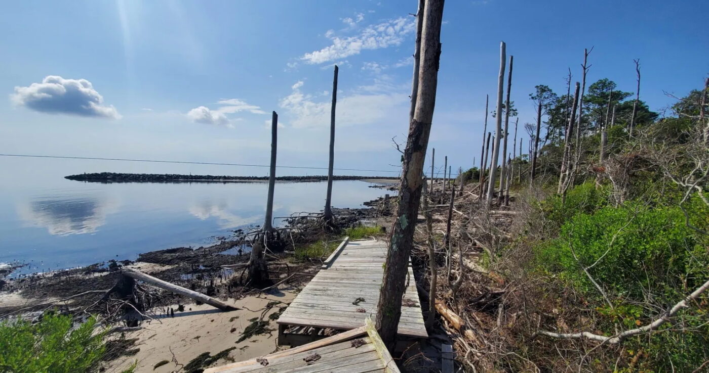
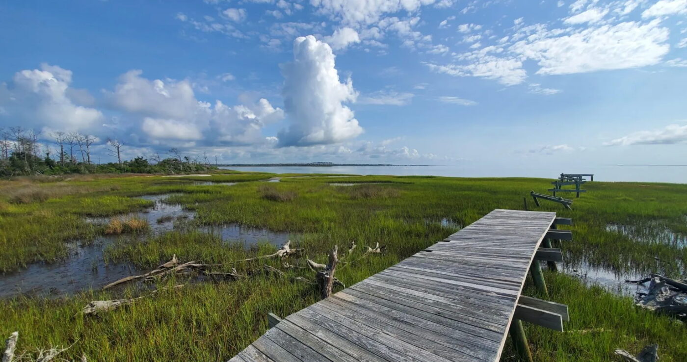
The spread of ghost forests is particularly pronounced on low-lying areas of North Carolina’s central coast, such as the marshy neck of land spreading northeast of Harkers Island. The peninsula is dotted with nearly two dozen small, rural waterfront communities — among them Atlantic, Sea Level, Davis, Smyrna, Gloucester — known collectively as Down East. The Carteret County area is particularly prone to flooding because of its ultraflat landscape.
The eastern shoreline of Down East is protected from storms and wave energy from the Atlantic Ocean by wetland ecosystems within the Core Sound and fortification from the Core Banks, a string of uninhabited barrier islands.
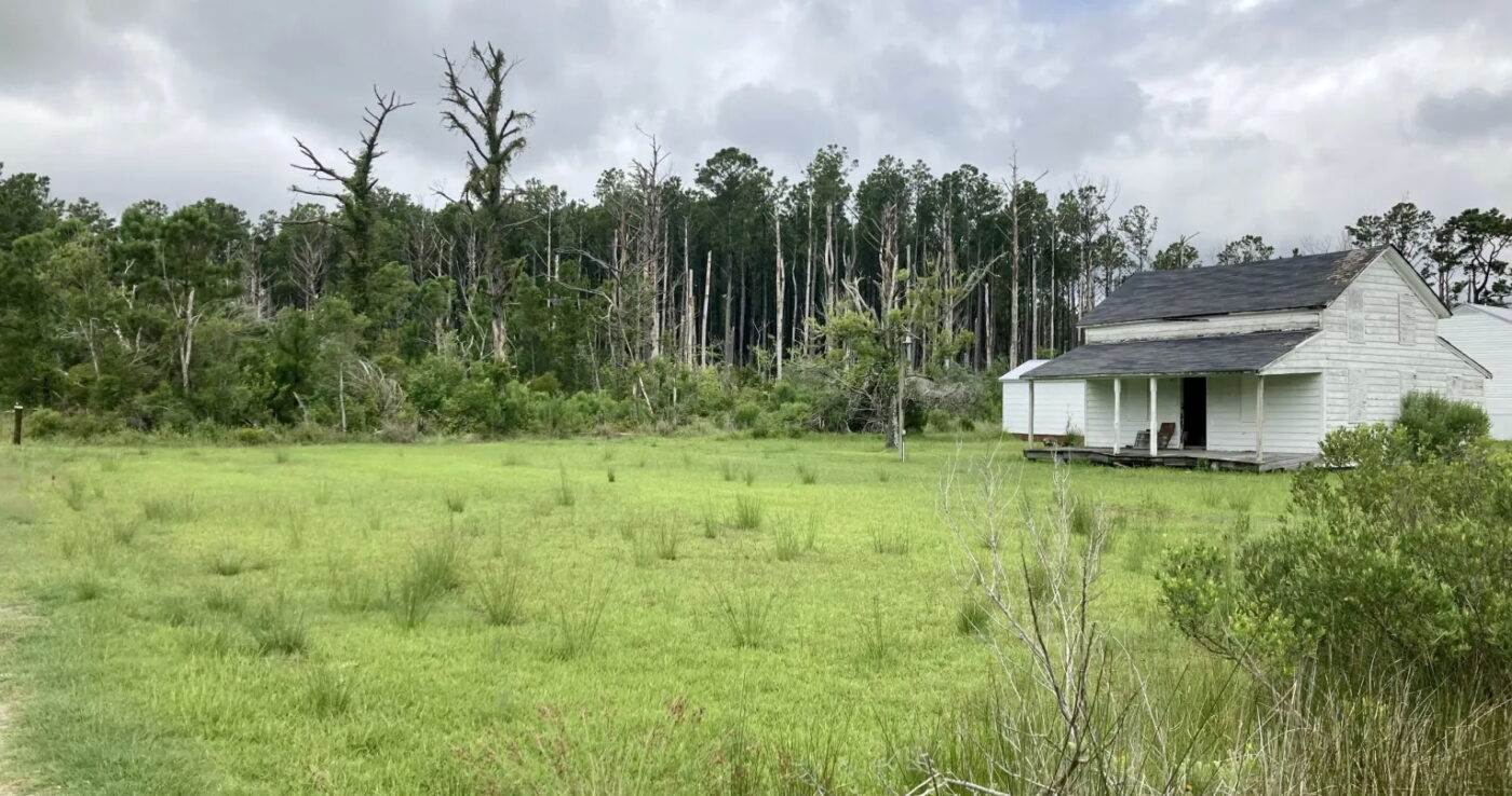
Despite nature’s protection, Hurricane Florence caused devastating and widespread freshwater and tidal surge flooding throughout the Down East peninsula in 2018. The storm killed trees on the shoreline, such as the patch on the edge of Harkers Island.
Patrick Gray, a doctoral candidate in marine science at the Duke University Marine Lab in Beaufort, said coastal forests are resilient and can bounce back from extreme weather events. However, forests farther inland are less adapted to storm surges and salty groundwater, so even a tiny increase in soil salinity can be deadly.
“It’s really these larger, low-lying areas of the inland coastal plain that will see meaningful changes to their forests,” he said.
Once dominated by wetlands and rich organic soil, Down East has a long history of agriculture. In decades past, large portions of the peninsula’s interior were drained by hydrological infrastructure, such as constructed canals and ditches to pump seawater out. The work made it possible to farm a once-soggy landscape.
“If you look at satellite imagery over decades, there’s just these tiny little canal lines everywhere,” Gray said.
But today, without protective measures, the hyper-connectivity of the drainage canals serve the opposite purpose.
As the sea level rises, salt water creeps inland as if the ditch is a seesaw tilting inland. Instead of helping agriculture thrive, the canals have become conduits for salty water to go even farther inland.
A slow-motion haunting
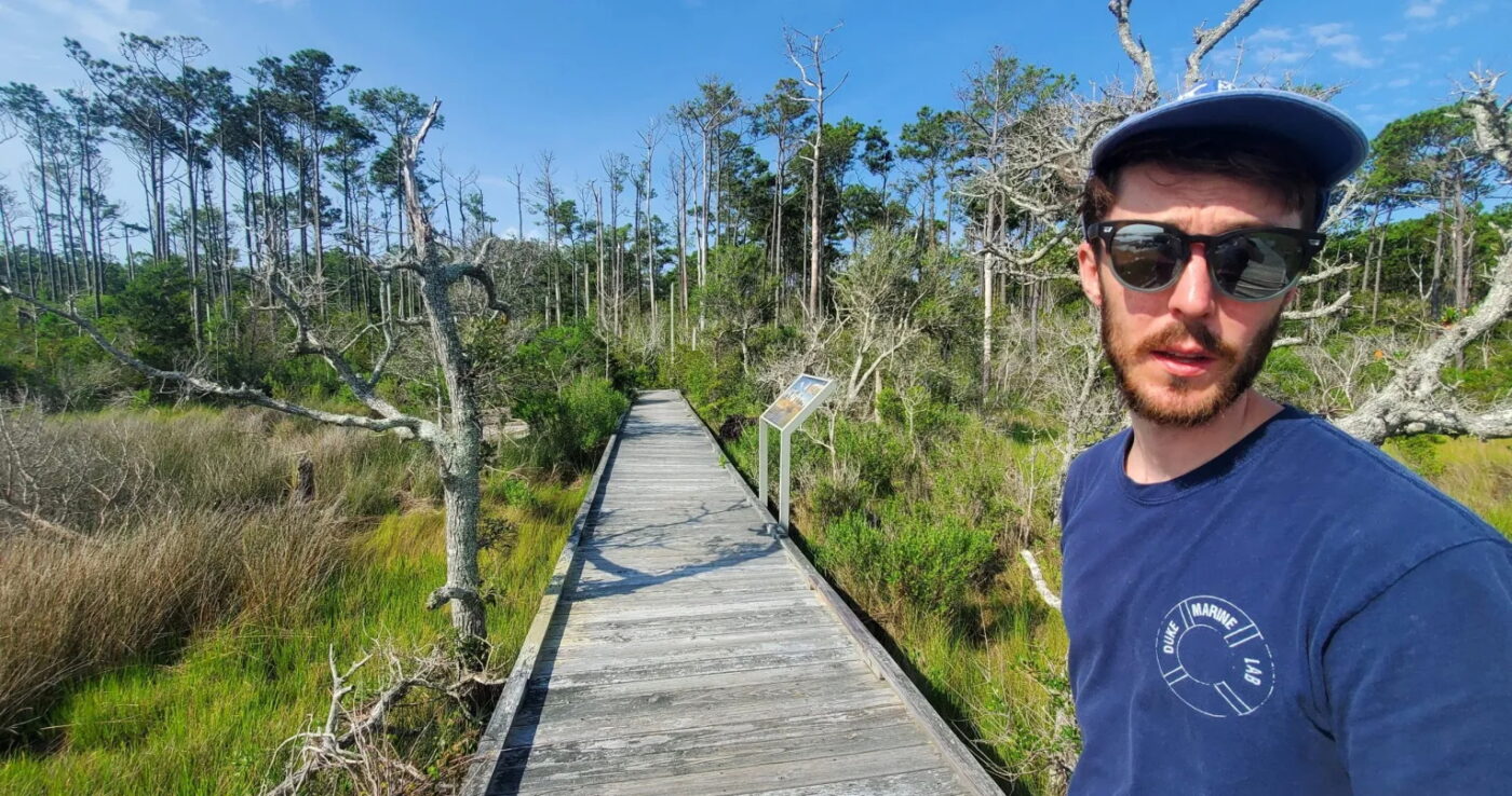
Using a combination of machine learning, three decades of satellite imagery and drones, Gray is able to track the expansion of ghost forests by developing high-resolution maps to observe how the coastline and its vegetation are affected by sea level rise, storms and other environmental changes.
“The length of the data set (over time) allowed us to see the evolution of ghost forest,” Gray said. It’s a slow-motion haunting, as the shifting ecological change occurs over months, years or decades.
Over time, the satellite imagery demonstrated that cropland becomes too wet to farm and turns into wetland forest. And as forests die off, they transform into emergent wetlands, such as swamps and marshes. Eventually, some wetland is overcome by seawater.
And then the combination of storms, erratic weather, land use patterns, droughts and sea level rise brought on by climate change may cause ghost forests to spread through at an accelerated rate.
For example, bays, inlets and sounds become saltier during prolonged droughts since evaporated water isn’t replaced by rainfall and inland runoff, thus stressing trees that are unable to quench their thirst. And as salt water poisons trees, they’re more susceptible to threats, such as invasive bugs, and therefore less resilient to future storms. This accelerates the pace of their demise.
Consider 2011, when Hurricane Irene made landfall at Cape Lookout on the southern tip of the Core Banks. The area is a case study in ghost forests because a severe multiyear drought preceded the storm.
“I cried when the arborist came to evaluate cutting the dead trees. He was so gentle about it. He understood what we were going through.” — Penny Hooper, Smyrna resident and co-owner of Hooper Family Seafood
“The double whammy seems to have caused a huge amount of tree mortality. There’s this idea of this ratchet effect of climate change,” Bernhardt said. “Nature is resilient. Forests, vegetation and animals may be lost due to a storm, but they come back. But I think we’re now seeing a systemic change as a result of a warming climate.”
The result may be that forests erode faster than they can recover — a progression that Down East residents are watching very closely.
Vulnerable landscapes, vulnerable ways of life
Among them is Penny Hooper, a former Carteret Community College biology instructor and potter who lives in Smyrna on a tidal creek on the Down East peninsula. Her husband, Mark Hooper, is a commercial fisherman. Together, they operate Hooper Family Seafood in Carteret County. They’ve raised clams for nearly four decades, pioneering the Down East aquaculture industry.
The two have seen changes to the forest firsthand, both from the water and from their porch.
Several years ago, she noticed pines dying on a headland visible from their property. She started to count the living ones.
“The first year there were 52,” she said. “The next year there were 38. Then 20. Then 10. After Florence, they were all gone.”
Recently, they took down 28 dead loblolly pines on their own 3-acre property.
“I cried when the arborist came to evaluate cutting the dead trees,” she said. “He was so gentle about it. He understood what we were going through.”
Even for visitors, the dying forests are unmistakable. Less evident, however, is the unyielding strain ghost forests and climate change put on the fabric binding communities together economically, historically and socially.
Down East, said cultural anthropologist, author and Gloucester resident Barbara Garrity-Blake, “is a peninsula with lots of little peninsulas within it. Before the bridges were built, people used skiffs to get around. People here are very oriented to the water.”
However, with the decline of the commercial fishing industry comes pockets of poverty and an aging population as new generations seek jobs elsewhere.
Garrity-Blake said that some older residents are leaving, too.
“Hurricane Florence really walloped Down East,” she said. “Some homes were so damaged that they got tired of having to cut their way out of their driveways and start over.”
The retreat of once-healthy forests is another item on a long list of traumas residents of Down East have endured over the years, including devastating storms, the opioid epidemic and losing their identity as a commercial fishing hub.
“I think there’s a growing recognition that, yes, the climate is happening,” she said. “Lawns turning into marshes isn’t normal. We’re getting king tides more frequently, and now, when you don’t get a big storm, it seems rare. It used to be the other way around.”
King tides are the highest predicted tides at a coastal location and can cause local flooding. As the sea level rises, king tides are extending farther inland.
An outcome of the hardscrabble, self-reliant temperament of Down East residents, is that none of the nearly two dozen communities on the island are incorporated. The closest things to a governmental entity are the fire districts whose stations serve as staging areas for storms and community events.
“Right now, we have problems that are too big for any one person or community to deal with alone,” said Garrity-Blake, who is part of an effort to form a collaborative partnership among eastern Carteret County communities.
Down East residents, however, don’t necessarily see ghost forests and climate change as an existential threat.
“They see changes and they recognize that these changes are real, but what many people see as an existential threat are the problems of fish politics, development, getting priced out of their communities,” she said.
Perhaps because of a strong oral tradition passed down generations, fishermen tend to see environmental changes — such as tree mortality, altered fish stocks or stronger storms — as part of the natural cycle of the maritime environment.
‘Embedded in the landscapes are literally the bones of our ancestors’
A deep connection to place is also at the nucleus of the cultural identity of indigenous people, said Duke University hydrologist Ryan Emanuel.
He collaborates with Emily Bernhardt to examine ghost forests in the Albemarle-Pamlico peninsula. He’s also an environmental justice scholar especially interested in questions relevant to Native American communities in North Carolina and beyond.
While teaching at N.C. State University a decade ago, Emanual organized environmental field days on the Lumber River with high school students in Robeson County, the political and economic hub of the 55,000-member state recognized Lumbee tribe. Emanual is an enrolled member of the Lumbee tribe.
“For tribal communities, we have to think about how we protect connections to places and the rights of native people to exercise sovereignty and make decisions about the future of their homelands.” — Duke University hydrologist Ryan Emanuel, an enrolled member of the Lumbee tribe
“I grew up with a sense of the (Lumber) river as the centerpiece of our homeland,” he said. “I wanted to share with young people the historical and cultural value of the river using scientific tools and techniques.”
As an environmental scholar, Emanuel understands the impact of climate change on the ecological structure of wetlands, such as the threat to biodiversity. However, his engagement with the Lumbee community highlighted the fact that climate change is also transforming the tribe’s cultural landscape.
“Even though we may not speak our ancestral languages, speaking for myself and a lot of other Lumbee people, we draw comfort from the fact that we can go out to these places and look at the same landscapes and the same riverscapes and know that our ancestors stood in the same spot and looked at the same views,” he said. “The Lumbee and other tribes draw their identity from centuries-old, or in some cases, millennia-old connections to very specific places, so an important dimension of environmental justice is protecting the places of cultural importance to indigenous peoples so they can continue to exist as distinct groups.”
While Robeson County is far enough inland from the problem of saltwater intrusion, the area isn’t immune to the impact of climate change, including recent droughts and flooding from tropical systems, such as Hurricane Matthew in 2016.
Emanuel pointed out that ghost forests, however, are intruding on the cultural landscapes of a broader community of indigenous people connected to the coastal plain throughout the southeastern coast. The Lumbee, he said, are a complex nation formed of remnants of native peoples from various regions throughout the coastal plain.
The archaeological record, however, wasn’t well curated along the coast. For example, mounds and other archaeological sites were plowed over or looted.
“Embedded in the landscapes are literally the bones of our ancestors,” he said. “So for tribal communities, we have to think about how we protect connections to places and the rights of native people to exercise sovereignty and make decisions about the future of their homelands.”
Emanual said that there’s renewed attention and reexamination of the Lumbee tribe’s connection to their ancestral landscape.
“Unfortunately, right as we’re starting that work and building on the work of our parents and grandparents, we’re seeing these really drastic environmental changes,” he said.
Conversations beyond scientists
The expansion of dead forests over years and decades, though startling to scientists, is not nearly as evident to the public as say, a catastrophic wildfire, hurricane or flash flood.
Nonetheless, Bernhardt said that expanding the conversation about the intensity and acceleration of climate change’s impact on sea level rise with people other than scientists is crucial to engage policymakers and develop adaptations.
For example, there may be places to implement targeted interventions to reengineer the agricultural drainage network or manage the transition of forests to wetlands.
“There are a lot of decisions we need to make,” she said. “There needs to be a coordinated conversation about this.”
“I’m taking all these baby live oaks and nurturing them. They won’t live to 200 years, but you know, they’re going to do something. I know they may not make it, but planting them makes me feel better.” — Penny Hooper, Smyrna resident and co-owner of Hooper Family Seafood
Meanwhile, the slow creep of rising seas will swallow, potentially, significant portions of Down East and other low-lying places on the North Carolina coast.
Hooper, the former biology teacher who watched her trees die on her property, said that people from Down East are adapting to the changes, such as raising homes, building artificial shorelines or planting sea grass.
“We’re doing the best we can to adapt, but people don’t want to call it climate change. They don’t want to use those words,” she said. “And that’s so sad because there are things related to climate change they can support, such as legislation to build new infrastructure or policies to slow the pace of greenhouse gas emissions.
“We’re doing things we can to help our piece of property, but the big picture of legislation, people are not supporting that.”
But, against the odds, live oaks began to sprout on her property after removing the dead pines. Since then, Hooper has planted more oaks and cedars, which are more resilient to saltwater intrusion than loblolly pines.
“I’m taking all these baby live oaks and nurturing them. They won’t live to 200 years, but you know, they’re going to do something,” she said. “I know they may not make it, but planting them makes me feel better.”
Jack Igelman is a contributing reporter with Carolina Public Press. Contact him at [email protected].
Carolina Public Press is an independent nonprofit news organization dedicated to nonpartisan, in-depth and investigative news built upon the facts and context North Carolinians need to know.